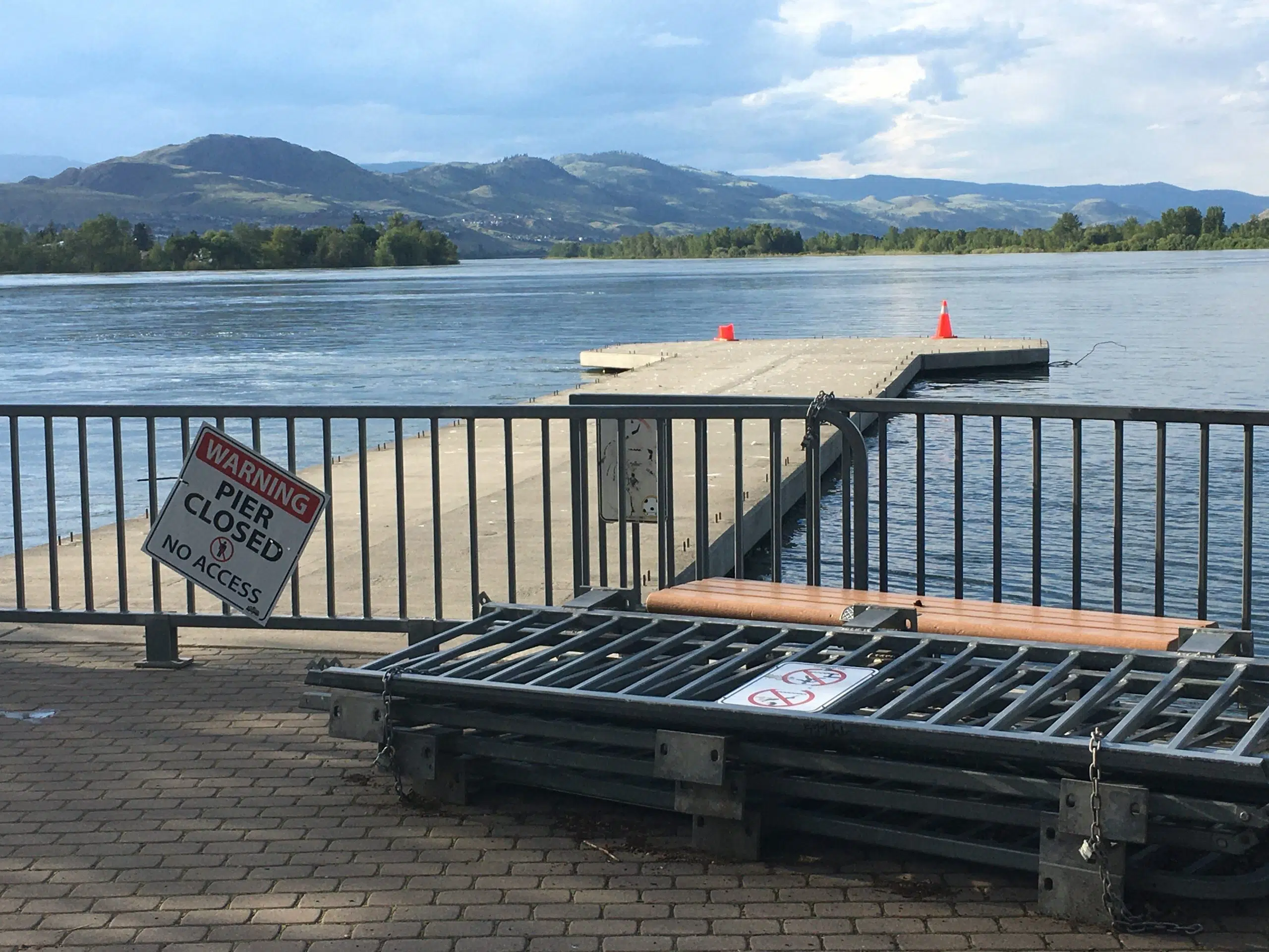
High water on the Thompson River in Kamloops in 2020. (Photo via Victor Kaisar)
Staff in the city of Kamloops are continuing to keep an eye on the river after recent spikes in the water level because of rain that fell last week.
“We are still hearing from the BC River Forecast Centre about the possibility of a one-in-20 type flood event, something similar to 1999, which is what we have been preparing for all year,” Utility Services Manager Greg Wightman said on NL Newsday.
“Fortunately at this point, we are prepared for that level, so there’s not a lot else we need to do other that just really keep a close eye on things. We’re right about the peak of these rivers and the rainfall certainly throughout Tuesday and into the early part of Wednesday last week did not help us.”
Environment Canada says 42 mm of rain fell in Kamloops in June, which is ten per cent more than the normal. It was immediately followed by the fifth-wettest Canada Day on record, where 11.2 mm of rain fell.
As of Sunday morning, the BC River Forecast Centre is maintaining a flood watch for the North and South Thompson rivers, however tributaries of both rivers are now under high streamflow advisories. A flood warning remains in place for the Bonaparte River near Cache Creek, where around a dozen properties were evacuated yesterday, while hundreds more remain on flood watch.
“The rain is the real challenge in trying to predict things right now. When its snow melt, there’s a little bit more lead time, a little bit more information that is available to you,” Wightman added, as Environment Canada is calling for the possibility of more rain in the forecast today and tomorrow.
“The forecast changes constantly, and we just continue to get all of the information we can through the provincial coordination calls to try and project what may happen.”
As of 11:40 a.m. on July 6, the water level on the Thompson River at the Overlanders Bridge was 7.494 metres, down from about 7.8 metres back on Saturday.
For the latest from the River Forecast Centre, go here.


