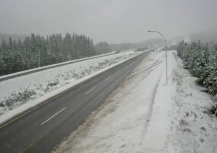
Snow on the high mountain highways in the Kamloops area should begin to taper off later today, according to Environment Canada.
However, meteorologist Doug Lundquist says you can still expect another 10 cm of snow at the Coquihalla Summit and about 15 cm on the Okanagan Connector by tomorrow.
“Its fall in the valley bottom, but it is winter up there in the high terrain absolutely, so we have to be prepared for that,” he said. “It warmed up enough this afternoon to be above 0 C there at the Coquihalla Summit, so from Kamloops through to Vancouver is probably above zero right now, but we are expecting the temperature to drop back tonight.”
A special weather statement is in effect from the Couqihalla from Hope to Merritt while a snowfall warning is in place for the Okanagan Connector from Merritt to Kelowna.
In Kamloops, Environment Canada is calling for rain today into tonight, with the snow level overnight projected to be about 1,400 metres. There is a mix of sun and cloud in the forecast for Wednesday and Thursday with highs around 10 C.
Lundquist says the snow at this time of the year is not uncommon, and he is urging drivers to check conditions regularly as the situation could change by the hour.
“It’s really evolving right now because we are at the tail end of this system and I want people to check and plan before they go, and if they can, pick the windows of warmer weather when its raining as opposed to snow, and try and avoid the worst days,” he added.
“It looks like we’re on the improving trend and tomorrow and Thursday should be better in general.”


