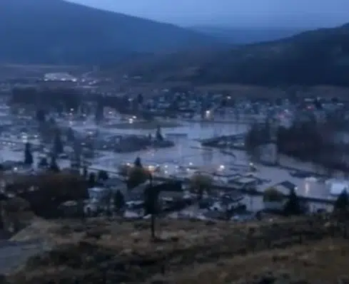
Part of Merritt have been evacuated because of floods. (Photo via Bailee Allen/facebook)
UPDATE 10:20 a.m. –
The entire City of Merritt is being ordered to evacuate because of heavy flooding.
In a statement Monday morning, the City said the surging flood waters have inundated two bridges across the Coldwater River, while preventing access to the third bridge.
Evacuees are being told to stay with friends or family outside of the community. People with nowhere to go are being told to head to Kamloops (if they live in odd-numbered houses) or Kelowna (if they live in even-numbered houses).
“Merritt is and will remain strong. At this time, we need everyone to proceed in a calm and orderly manner to safe locations in nearby cities. For your own safety, you must now leave Merritt, for the time being,” Mayor Linda Brown said, in a statement.
“Please, offer help to your friends, families, and neighbours, drive safely, and take care of yourselves. We will meet each other again, in our homes, where we belong.”
Evacuees are being told to register online here or to contact 1-800-585-9559 for more information.
“We have established a Muster Point at the Nicola Valley Memorial Arena where we will have bus evacuation services for individuals with mobility issues and those without access to vehicles or otherwise unable to find alternate transportation,” Merritt City staff added.
The Thompson Nicola Regional District has also issued a large scale evacuation alert for rural areas downstream of Kamloops Lake. It covers areas west of Savona and near Cache Creek, Ashcroft, Spences Bridge and Lytton.
Earlier this morning, the City of Merritt said its wastewater treatment plant had failed.
“Continued habitation of the community without sanitary services presents risk of mass sewage back-up and personal health risk,” it said.
The City says it has asked that all gas stations stay open for residents leaving the city.
In a press conference earlier this morning, B.C.’s minister of public safety, Mike Farnworth, hinted at the possibility that all of Merritt might be ordered to evacuate.
He also said there were between 80 and 100 vehicles stuck between landslides on Highway 7 near Agassiz. Search and Rescue crews are mobilizing, with Farnworth noting crews are looking at the possibility of rescuing people by air, but he noted that will depend on the weather and forecasted winds.
People are being told to not travel on Interior highways, unless absolutely necessary, though there are a number of highway closures in place. That includes Highway 3 east of Hope, on the Trans Canada between Sicamous and Revelstoke as well as near Spences Bridge, and on the Coquihalla between Hope and Merritt.
“We do have early reports that there is some damage along the [Coquihalla] corridor, although it’s too soon to know the full extent of that damage, which is going to determine the length of the closure,” Paula Cousins, with the Ministry of Transportation said Monday, noting crews will begin to survey the damage this morning.
“The corridor has received approximately 200 mm of rain and continues to experience heavy precipitation. Our experts are going to fly the corridor as soon as they’re able to get up there.”
“Safety is our highest priority,” Cousins added, noting if people do need to travel, they should watch for polling water, have a fall tank of gas, completely charged cellphones, as well as food and water.
Environment Canada meteorologist Armel Castellan says while the atmospheric river storm is expected to end Monday, there are winds gusts of up to 90 km/h expected in the Interior, which could lead to more power outages.
He says some areas have seen more rain in the last 24 to 36 hours than they do in all of November, which is normally one of the province’s wettest months.
While Farnworth had said the hope was that Highway 1 though the Fraser Canyon would reopen by 5 p.m. today, he cautioned that could change. Like a portion of the Coquihalla north of Hope, a portion of Highway 1 near Tank Hill was washed out by floods.


