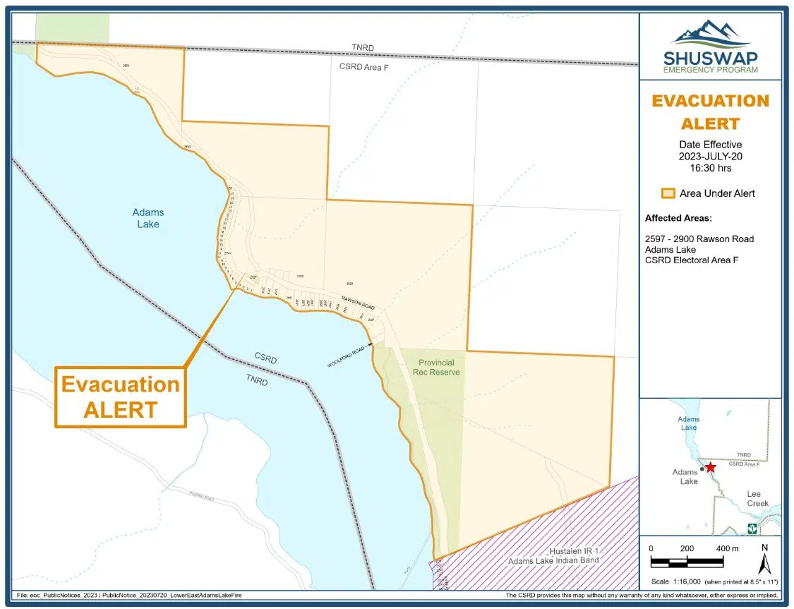
The Thompson-Nicola Regional District and the Columbia-Shuswap Regional District have issued evacuation alerts due to the Lower East Adams Lake wildfire.
While the TNRD’s alert covers just one property in the vicinity of McLeod Point in Electoral Area “O”, the CSRD’s alert covers 92 properties from 2597 to 2900 Rawson Road in Electoral Area “F”, on the east side of Adams Lake.
An evacuation alert was also put in place by the Adams Lake Indian Band, though it is not clear how many properties it covers. A map shows the band’s alert covers Chief Atahm Drive and Stalnac Way.
“This Evacuation Alert is in place to prepare you to evacuate your premises or property, should it be found necessary,” the TNRD statement said. “Residents will be given as much advance notice as possible prior to an Evacuation Order; however, you may receive limited notice due to changing conditions.”
The CSRD also cites limited transportation options in the area, which is accessible by the Adams Lake Bridge and the Adams Lake Cable Ferry.
An Evacuation Alert has been issued by the CSRD for 92 properties in the Lower East Adams Lake Area of Electoral Area F. See https://t.co/YK7A8V2rq2 for more. https://t.co/XYQc3oOlJ5 pic.twitter.com/QrCUOHMio1
— Columbia Shuswap Regional District (@ColShuRegDist) July 21, 2023
The TNRD Emergency Operations Centre has an issued an Evacuation Alert for approximately one addressed property in Electoral Area “O” (Lower North Thompson) due to the Lower East Adams Lake Wildfire.
Details: https://t.co/lsX8SHPxy5 pic.twitter.com/z15EeLJbdB
— TNRD (@TNRD) July 21, 2023
The BC Wildfire Service says the suspected lightning caused fire – which has been burning since July 12 – is now estimated to be 70 hectares in size.
“Today, a helicopter provided successful bucketing suppression on the south flank of the fire where fire behaviour was observed to be a smouldering ground fire with low vigour,” the Wildfire Service said.


