


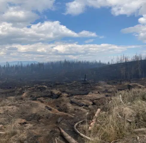
Damage from the Bush Creek East fire/via BC Wildfire Service
This recent rain, while helping fire crews battle the fires, are also giving the BC Wildfire Service a better ability to map-out the three fires on either side of Kamloops.
The Ross Moore Lake fire is now mapped out at roughly 72.5-square kilometers in size.
While it has continued to grow, it has not made any progression toward Kamloops, with the north edge holding at about 10-kilometers from the city.
This is up from the previous estimate of 62.4-square kilometers.
To the northeast of Kamloops, the Lower East Adams Lake fire is now listed at around 65-square kilometers in size.
This is up from the previous estimate of around 48-square kilometers.
The Bush Creek East fire has grown to over 30-square kilometers, up from just under 18-square kilometers at the previous estimate.
Over 100 properties on either side of Adams Lake remain on evacuation orders due to both those fires.
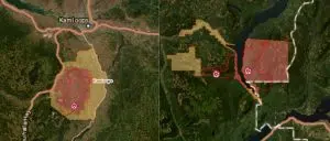
Maps showing the Ross Moore Lake fire (L) and the Bush Creek East and Lower East Adams Lake fires (R)/via BC Wildfire Service


