


View of the area impacted by the Saw Creek fire next to the Village of Lytton (cleared area to left) taken Monday afternoon, June 22, 2026. Fire burning in the forested area to the south (right) of Village on either side of the TransCanada Highway (line at bottom of hill)/via BC Wildfire Service
Cooler overnight temperatures into Tuesday have helped maintain the status quo for the fire burning near Lytton.
The BC Wildfire Service is reporting a decrease in fire activity coming into day 5 of the battle .
It says its crews are continuing to focus on securing the perimeter of the blaze with fire guards, which will allow the fire to ultimately burn itself out.
The latest update as of Tuesday morning shows no increase in the overall size of the fire, which has been listed as 704 hectares since an update on Sunday morning.
It’s not clear if this is due to containment or a lack of accurate mapping from aircraft, though an earlier Yellow Alert for wildfire smoke from Environment Canada is no longer in effect.
The BC Wildfire Service says the Saw Creek fire is burning at comparatively low levels, listed as rank 1 and 2, compared to the rank 4 and 5 the inferno was listed as after it first broke out on Friday afternoon.
Close to 200 Wildfire personnel and other crews from the area remain on the ground.

Map of Saw Creek wildfire zone showing evacuation zones, none of which were impacted through Monday/via TNRD[Click photo to EXPAND]
A total of 214 properties — mostly in the Village of Lytton — remain under an Evacuation Alert.

View of the area impacted by the Saw Creek fire (red highlight) next to the Village of Lytton (Green Highlight)/via BC Wildfire Service
Authorities have yet to provide an assessment at this time of any damage to infrastructure which may have occurred in the early stages of the fire on Friday, when it tore through the wooded areas on both sides of the TransCanada about 5 kilometers south of the Village of Lytton’s southern boundaries and made its way north across Lytton First Nation territory at a pace of around 100 hectares per hour at the time.
Unconfirmed reports at that time suggested as many as five homes in the path of that fire may have been consumed or severely damaged in the fast-moving fire, the cause of which is listed as “human,” but has not been specified at this time.
BC Wildfire says its crews continue to cut out a 50 foot wide path along the upslope of the hills south of the Village of Lytton to ensure that the flames — if they do flare up — can’t make the jump over the north flank and start threatening that portion of Lytton.
That is the one small portion of Lytton which managed to survive the flames which ripped through the community nearly 5 years ago — June 30, 2021 — destroying around 90% of the community’s infrastructure and leaving two people dead.
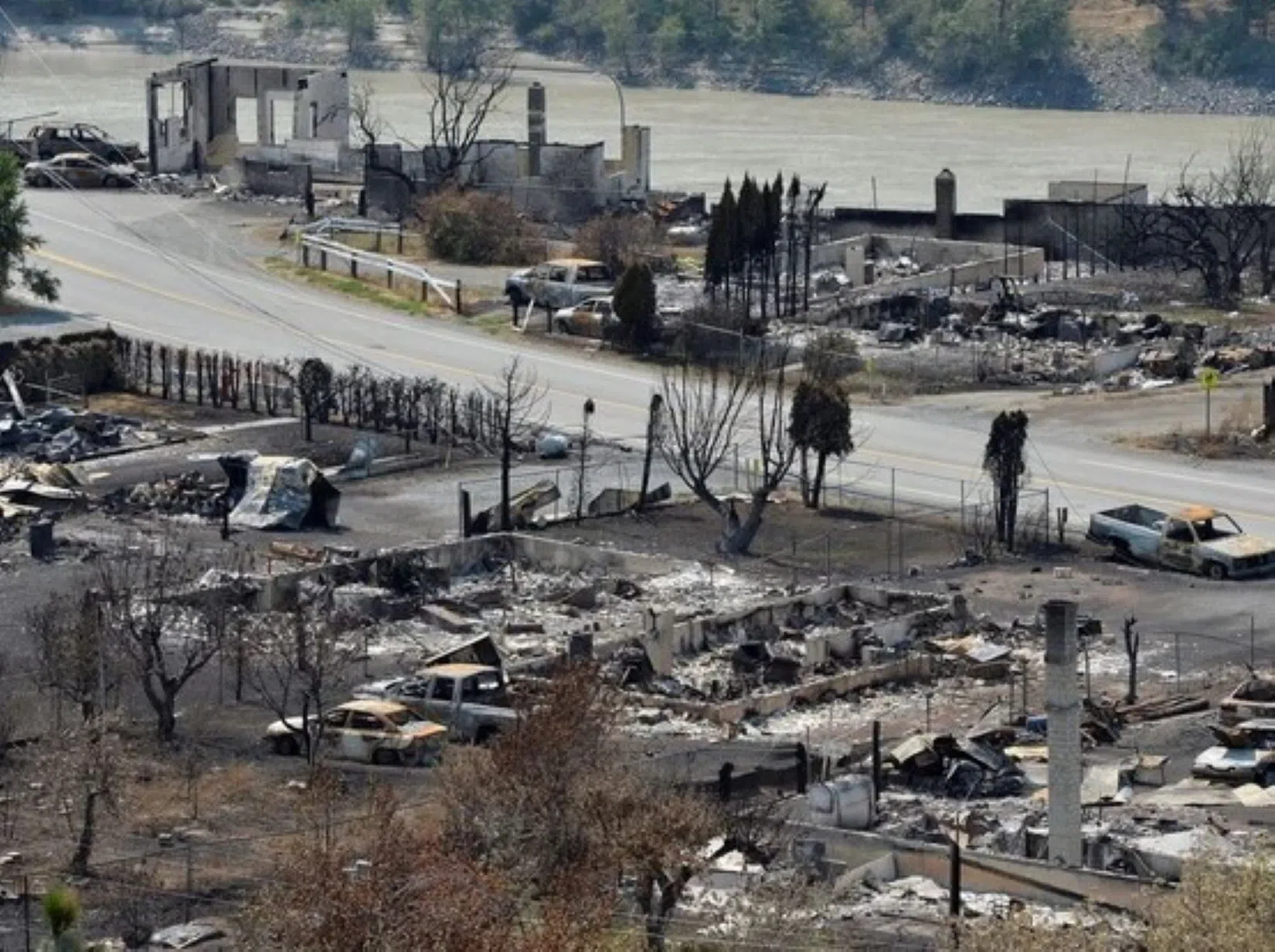
Aftermath of Lytton following the fire which destroyed the Village in 2021/via Jennifer Gauthier, Reuters
Meanwhile, a secondary ‘control line’ about 100 feet wide is being carved out along the edge of the TransCanada Highway on the west side of the fire to try to ensure any flare-up of the blaze would not have an easy time taking out infrastructure closer to — and on the opposite side — of the Fraser River.
Canadian Pacific’s rail connection through the Fraser Canyon runs along the east side of the Fraser River where the fire has been burning.
It’s not clear if any damage has been done to CP’s infrastructure due to the Saw Creek fire.
The Canadian National line runs on the opposite side of the Fraser until its critical bridge crossing, which crosses over at Lytton near the Village’s south end.
While both of those lines are the only rail connection between the rest of Canada and the Lower Mainland — including the critical Port of Vancouver — the CN bridge is also a critical lifeline for those in Lytton.
A sizeable portion of those who continued to make Lytton home after the devastation of five years ago have taken up residence on the so-called “west side” of the community, which are lands maintained by either the Lytton First Nation or the Thompson Nicola Regional District.
The “west side” of the Fraser River is notoriously inaccessible, as only the Lytton Ferry provides direct vehicle access to the community on the other side.
But that service operates as a reaction ferry, which uses the flows of the Fraser River itself to make it across using guide wires, and has — until this Tuesday — been shut down due to high water flows and debris from the remainder of the snowpack melt from upstream, meaning the only other way across — save for a treacherous, at least one hour drive north across unmaintained roadways to a crossing at Lillooet — is via a pedestrian bridge that CN sanctioned in 1960, then widened in 2008 to allow for more critical access.
This includes bicycles, gurneys and — in some instances — smaller motorized vehicles such as quads to make the crossing, but only with permission.


