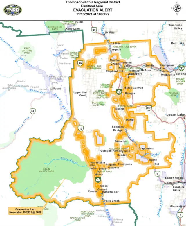
A large-scale evacuation alert has been issued for rural areas downstream of Kamloops Lake because of the risk of flooding.
The Thompson-Nicola Regional District has issued the alert for Electoral Areas I, M and N, covering areas west of Savona and near Cache Creek, Ashcroft, Spences Bridge and Lytton. It’s unclear exactly how many properties are affected, but a map highlighting the areas affected can be found here.
“Residents will be given as much advance notice as possible prior to the evacuation; however you may receive limited notice due to changing conditions,” a news release from the TNRD says.
People on evacuation alert are recommended to pack up essential items like government-issued ID, medications and valuable papers, to prepare to move family or neighbours who have disabilities, and to arrange transportation and accommodation.
This comes in the same hour that the City of Merritt ordered all residents to evacuated, because of flooding from the Coldwater River cutting off water and sewage usage for residents.
Merritt residents have been advised to evacuate to Kamloops or Kelowna; in Kamloops, an evacuee reception centre has been set up at McArthur Island.
There are no travel issues for the Coquihalla between Merritt and Kamloops nor the Okanagan Connector, but Highway 1 is closed between Lytton and Spences Bridge. Highway 8 remains open east of Spences Bridge and Highway 12 is also open between Lytton and Lillooet.
Catastrophic flooding has occurred at the Coldwater River in Merritt, and a flood warning remains in place. Meanwhile, a less-severe flood watch is in place for the Nicola River between Merritt and Spences Bridge.
There are no flood warnings or high water advisories in place on any part of the Thompson River at this point. A fulsome map from the BC River Forecast Centre can be found here.
More to come.


