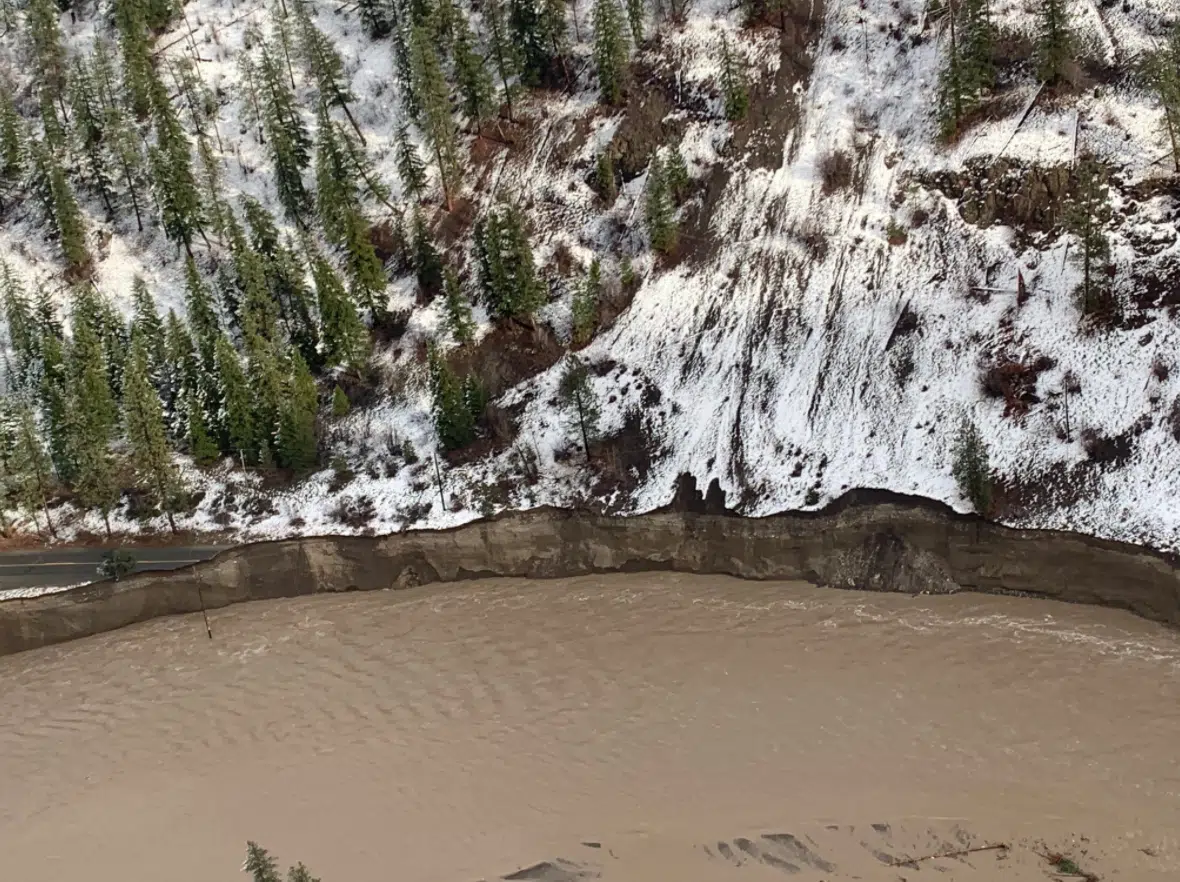
Sections of Highway 8 west of Merritt have been washed out by high water on the Nicola River. (Photo: Ministry of Transportation)
New photos show sections of Highway 8 have been washed out between Merritt and Spences Bridge, as several dozen nearby properties have been evacuated.
The evacuation order came into place Tuesday night, and affects 37 properties in the Thompson-Nicola Regional District, from just about 25 kilometres west of Merritt to just east of Spences Bridge. A list of the addresses affected can be found here.
All Shackan Indian Band properties on the Highway 8 corridor have also reportedly been evacuated because of flooding.
A flood warning has been in place for several days for the Nicola River along through that area, as well as the Coldwater River which drains into the Nicola and has devastated the City of Merritt with flooding.
Pictures shared by the Ministry of Transportation show large areas of the highway has been washed out.
There’s no estimate for a time of reopening, according to DriveBC, but initial estimates say the highway will likely be closed for several weeks at least.
Meanwhile, on early Wednesday afternoon, the TNRD lifted an evacuation alert that has been in place since Monday for the Thompson River watershed, downstream of Kamloops Lake.
A look from yesterday afternoon at #BCHwy8
Via @DriveBC – Closed due to flooding between Porcupine Ridge Rd and Petit Creek Rd for 33.5 km (east of #SpencesBridge to 17km west of #Merritt). Assessment in progress. Estimated time of opening not available. https://t.co/KlVsUcVW9g pic.twitter.com/NEbfiHRvcJ— BC Transportation (@TranBC) November 17, 2021