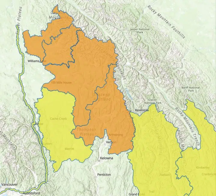
With the potential of heavy rain in the forecast, the BC River Forecast Centre has upgraded a high streamflow advisory to a flood watch for the Thompson River from Kamloops to Spences Bridge.
It says there could be as much as 40 mm of rain in areas of the North Thompson, South Thompson, Cariboo Mountains, and Upper Columbia watersheds.
“Rivers in the region are flowing very high for this time year and are extremely vulnerable to a additional runoff at this point,” the River Forecast Centre said.
“An upcoming major concern is the weather forecast for a potential long-lasting rain event in the headwaters of the South Thompson, North Thompson and Cariboo Mountains later Tuesday through early Thursday.”
The River Forecast Centre says if there was to be widespread heavy rain, rivers in the area will reach the highest level of the season leading to the potential for significant flooding to occur.
“Warming temperatures over the weekend and into next week will lead to accelerated snowmelt rates where snow remains, however there remains uncertainty over the extent to which the available remaining snowpack will be able to fuel significant additional rises to rivers next week,” it said.
“At present, the key weather of concern for flooding in the region is the immediate rainfall pattern on Tuesday to Thursday.”
The City of Kamloops is preparing for the worst case scenario as it says the North and South Thompson rivers could peak at the same.
“With this rain that is forecast, there is the possibility of the North Thompson peaking in and around Friday or Saturday, and the South Thompson potentially peaking towards the end of the weekend, early next week,” Utility Services Manager, Greg Wightman, said.
“That synchronization of the peaks looks like its going to happen this year, and it is just going to be a matter of how high those peaks are.”
Flood watches also remain in place on the North Thompson River and its tributaries in Barriere, Clearwater, and Blue River, as well as for the South Thompson River and its tributaries in the Shuswap – the Seymour, Eagle, Adams, and Shuswap rivers.
The Columbia-Shuswap Regional District says it has crews currently out making assessments of potential danger areas because of the heightened risk of flooding.
“Sandy Beach, which is located in Blind Bay, and the Scotch Creek Wharf Road Community Park, the water levels are very high at both those locations and so we’ve temporarily closed those parks,” CSRD spokesperson Tracy Hughes told NL News.
Similar to the City of Kamloops, the CSRD has activated its Emergency Operations Centre, with Hughes adding they’re close tabs on both the weather and the lake levels over the next couple of days.
“It is looking about 349 metres, which is into a flood level but not as high as 2012 but certainly enough that it is causing us some concern,” Hughes added.
“We are preparing but should we breach the 349.2 mark, that is where the situation gets a little more dire in the District of Sicamous, and flood waters can move towards the downtown.”
As it stands, the Nicola River near Merritt remains under a high Streamflow Advisory.
For the latest from the River Forecast Centre go here.
– With files from Paul James


